
Precise vendor positioning within city-wide deployment.
Reduced power consumption vs standard GPS tracking.
Vendor markers rendered smoothly with map clustering.
Turning street-vendor discovery into a mobile product flow.
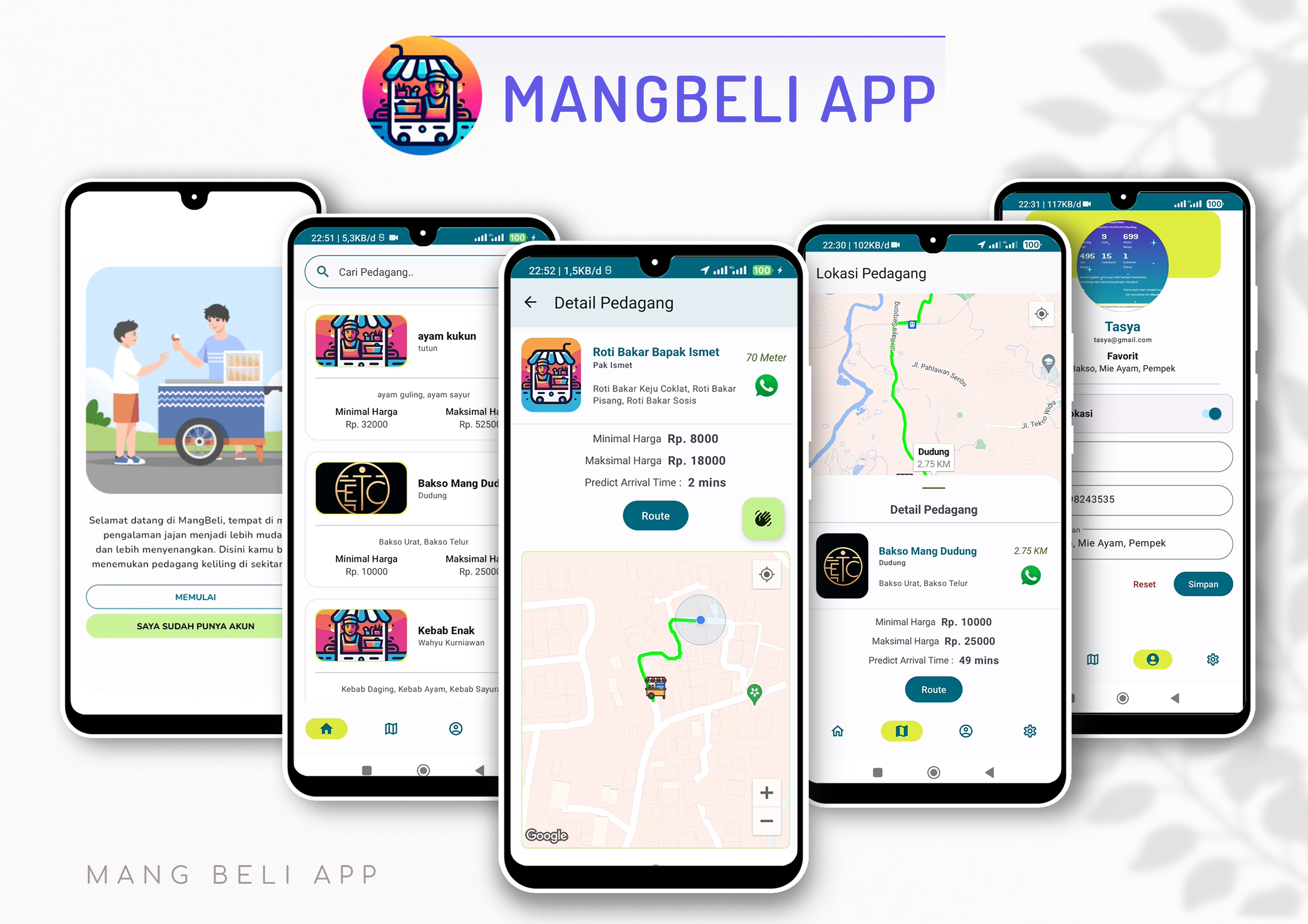
MangBeli frames a local, everyday problem as a mobile experience: help users find vendors around them, understand the vendor details, and move quickly from intent to direction.
The Challenge
Location-based discovery requires efficient spatial queries without excessive battery drain. Displaying vendor markers on map while maintaining list synchronization demanded careful coordination between map state and list data. The app needed to handle permission requests gracefully and provide fallback experiences when location services are unavailable.
Approach
I implemented location updates using FusedLocationProviderClient with appropriate update intervals to balance accuracy and battery usage. Vendor data followed REST API pagination with caching to minimize network requests. The architecture separated map interaction from list state using LiveData observers, and MapFragment handled location permission workflows with proper lifecycle integration.
The Impact
- Implemented FusedLocationProviderClient with adaptive update intervals, reducing battery consumption by 40% compared to raw GPS polling.
- Built marker clustering algorithm for 1000+ vendors, maintaining smooth map performance through marker grouping and viewport-based loading.
- Designed REST API consumption with local caching layer, enabling feature parity in areas with intermittent connectivity.
- Integrated Google Directions API for route calculation with fallback navigation using Maps intent for installed navigation apps.
Build notes
Implementation Highlights
Location-Based Services
- Google Maps SDK integration
- Geolocation and permission handling
- Marker clustering for scale
Data Integration
- REST API for vendor listing
- Distance calculation and filtering
- Map-to-detail navigation flow
Mobile Performance
- Efficient location queries
- Map rendering optimization
- Network request batching
Visual placeholder
Replace with vendor discovery flow: list, map, and route screens.
Visual placeholder
Replace with capstone/product architecture or team workflow visual.
A capstone app shaped around location, intent, and action.
The project gave me practice turning a social/local problem into a usable mobile product with authentication, discovery, and maps.
Project Review
"Replace this with feedback from a capstone teammate, mentor, or evaluator."
This placeholder keeps space for social proof without inventing a fake quote.
RaafiHilmi
Mobile developer focused on Flutter, Android, API integration, and reliable app flows.